
Kindergarten Geography Terms and Mapping Vocabulary worksheets introduce young learners to basic concepts such as landforms, directions, and map symbols. These foundational skills help children understand their environment and develop spatial awareness. Explore the available worksheets to support early geography learning and make map-reading fun for your child.
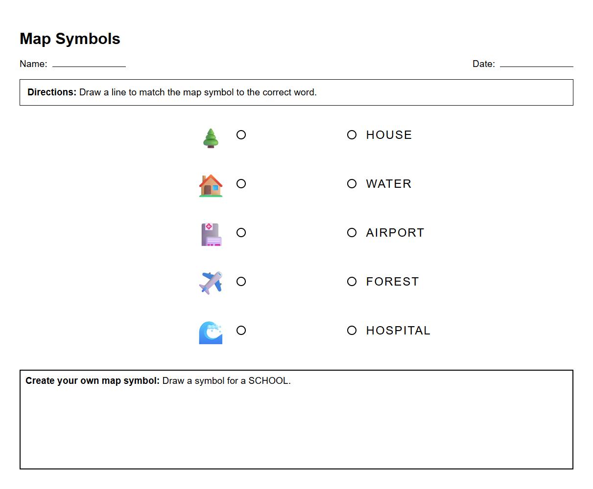
Kindergarten Map Symbols Recognition Worksheet


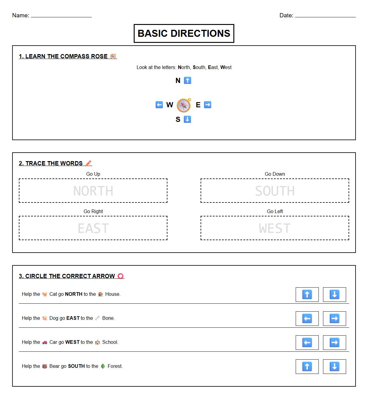
Basic Compass Directions Vocabulary Worksheet

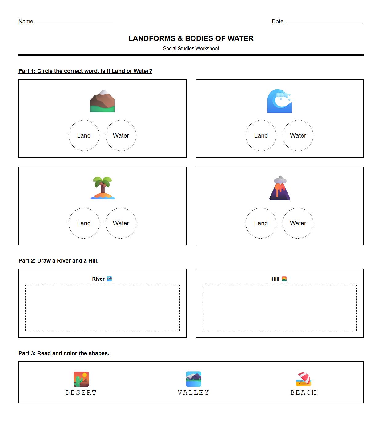
Landforms and Bodies of Water Identification Worksheet

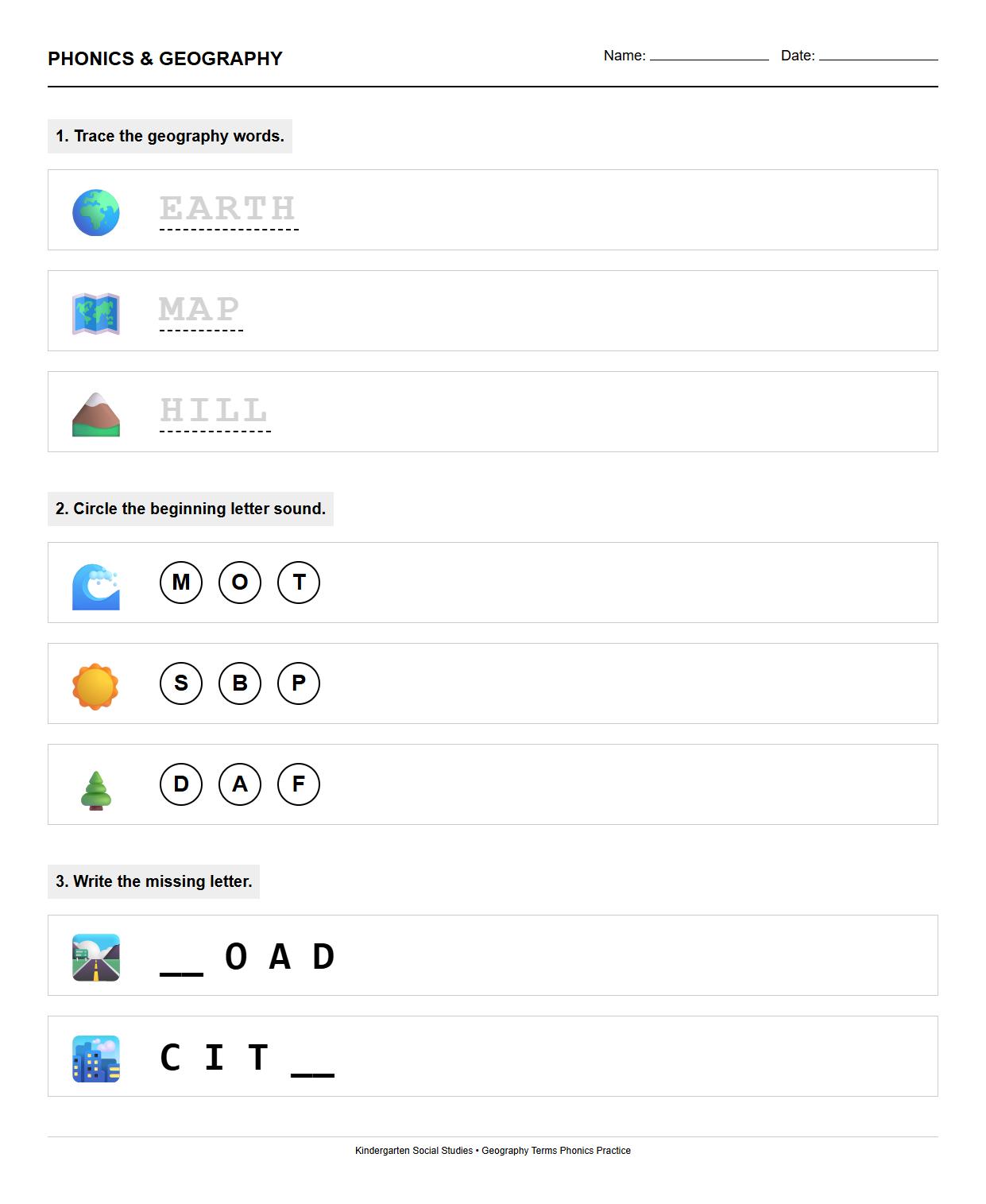
Phonics Practice with Geography Terms Worksheet

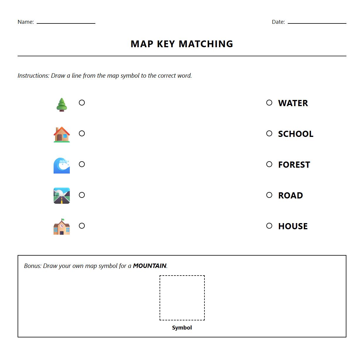
Simple Map Legend and Key Matching Worksheet

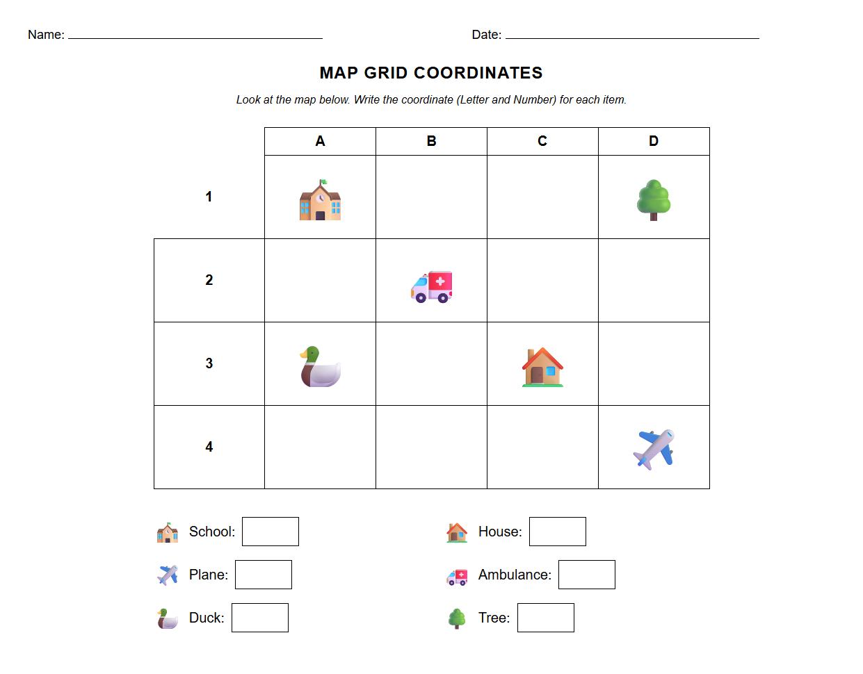
Understanding Location with Grid Coordinates Worksheet

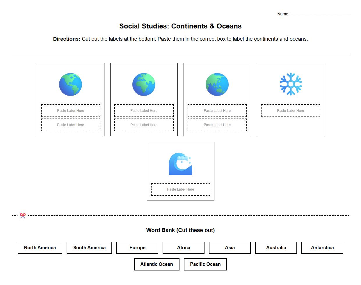
Cut and Paste Continents and Oceans Worksheet

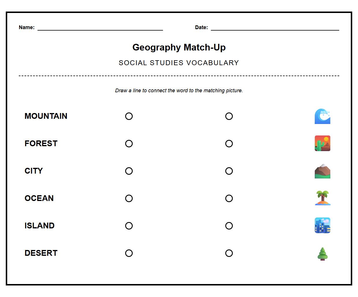
Geography Vocabulary Picture Association Worksheet

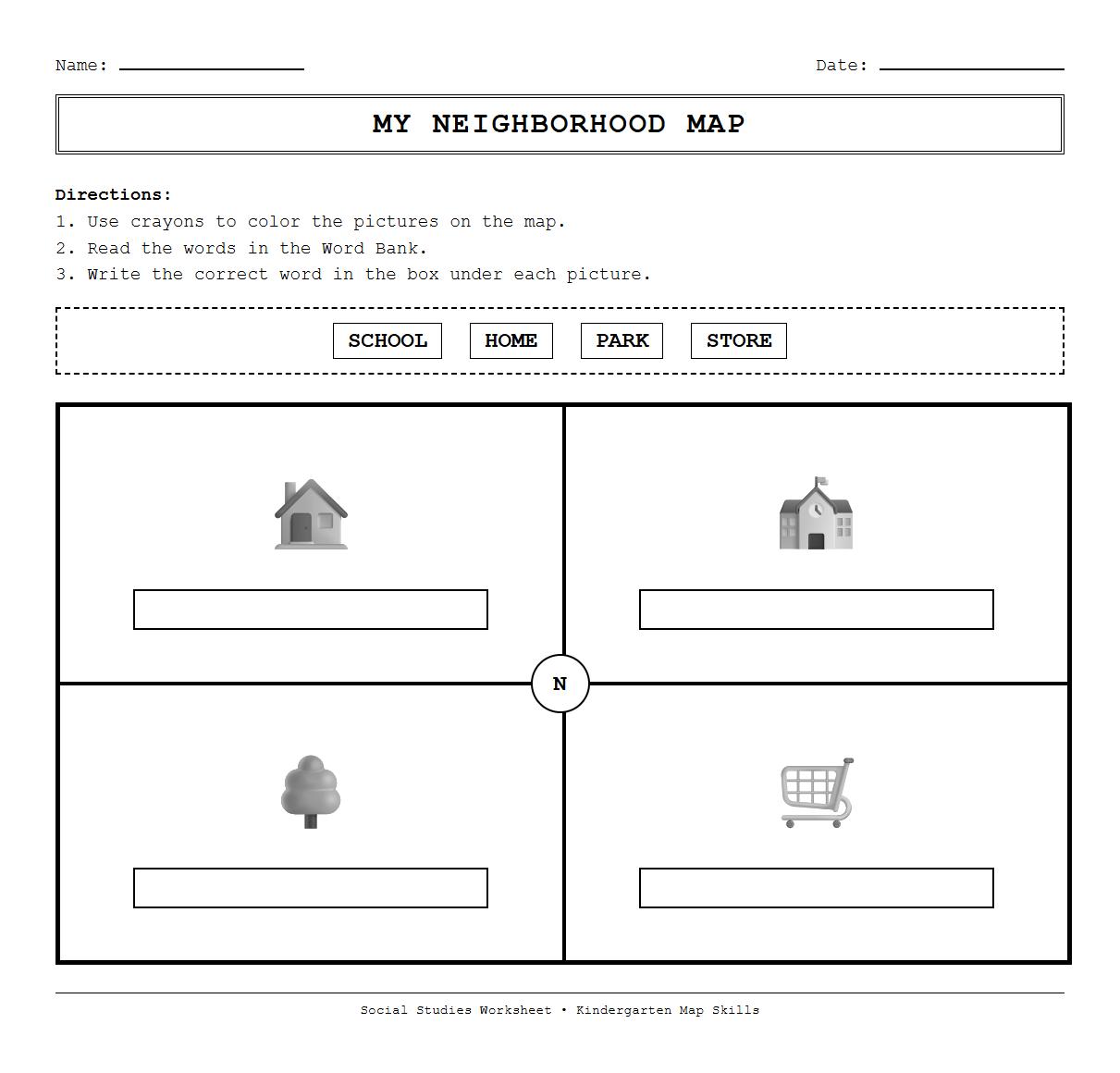
Map Coloring and Labeling Worksheet for Young Learners

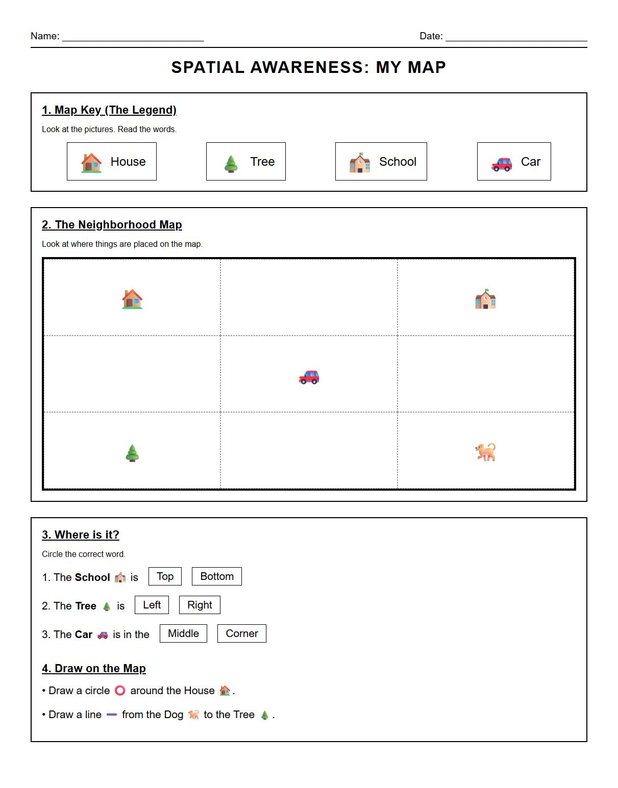
Spatial Awareness Activities using Map Elements Worksheet

 Phonics Worksheet Activities for Kindergarten Holiday Celebrations